Asset Management
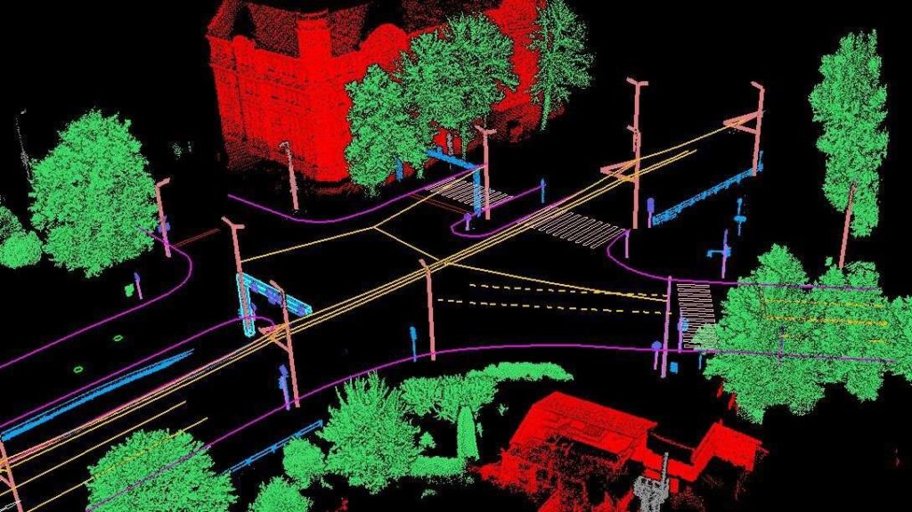
GeoAI presents an advanced and user-friendly solution tailored for the comprehensive inspection of power lines through the analysis of LiDAR point clouds. This cutting-edge GeoAI technology boasts a range of powerful tools, catering to both automated and manual classification of critical elements such as power lines, transmission towers, vegetation, buildings, and various other objects of interest within the surveyed area.
Powerline Digital Twin
One notable feature of GeoAI is its capability to automate the detection of user-defined danger points, addressing concerns such as vegetation encroachment and potential tree fall hazards. This ensures a proactive approach to risk management and enhances the overall safety and reliability of power line infrastructure.
Moreover, GeoAI goes beyond mere analysis by incorporating built-in reporting functions that empower users to swiftly generate detailed project reports. These reports provide a comprehensive overview of the inspection results, facilitating informed decision-making and streamlined communication within project teams. The versatility of GeoAI extends to result exports, allowing users to seamlessly transfer findings in KML formatted files, ensuring compatibility and ease of integration with other geospatial systems and applications. In essence, GeoAI not only simplifies and enhances the power line inspection process but also contributes to a more informed and proactive approach to infrastructure management.
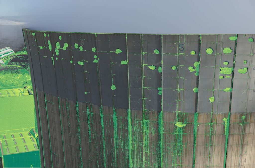
Infrastructure Health Monitoring
In a world where aging infrastructure poses a global challenge and potential failures could have catastrophic consequences, GeoAI steps in as a solution. Traditional methods of inspection for structural defects are not only costly and time-consuming but also pose significant risks. GeoAI revolutionizes this process by harnessing the power of close-range photogrammetry and machine vision.
This innovative approach enables us to detect structural defects in infrastructure effectively and efficiently. By utilizing advanced technology, we ensure accurate assessments while minimizing costs and time, ultimately contributing to safer and more sustainable infrastructure management.